
Marigot, Dominica – June 28, 2024
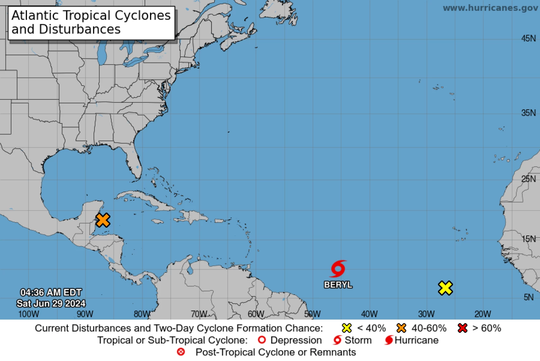
The National Hurricane Center (NHC) has issued advisories on Tropical Storm Beryl, which has recently upgraded and is currently situated over the central tropical Atlantic Ocean. With the storm rapidly gaining strength, it is anticipated to transition into a hurricane by Saturday night or Sunday.
A Hurricane Watch is now in effect for Barbados, and interests throughout the Lesser Antilles are urged to closely monitor Beryl’s progression. Additional watches and warnings for other areas in the region are expected to be issued later today.
Storm Path and Intensity
As of Saturday morning, Beryl’s center was moving westward at approximately 21 mph. This westward to west-northwestward trajectory is forecasted to continue over the coming days. The storm is expected to cross the Windward Islands late Sunday night into Monday.
Currently, Beryl’s maximum sustained winds have reached 50 mph, with higher gusts recorded. The NHC predicts steady to rapid strengthening over the next couple of days, with Beryl potentially reaching hurricane status as it approaches the Caribbean. Tropical-storm-force winds extend up to 45 miles from Beryl’s center.

Potential Impact
Once within the Caribbean, Beryl will encounter prime conditions for further intensification, including hot waters and low wind shear. The NHC’s official track suggests Beryl will be a hurricane as it moves through the Caribbean, though intensity models indicate potential fluctuations. Consequently, residents of the eastern Caribbean Islands should prepare for a storm potentially one category stronger than current forecasts.
Meteorological models consistently show Beryl staying over the south and central Caribbean through Tuesday afternoon, with its center remaining well south of Hispaniola. However, model predictions start to diverge beyond Wednesday, with some indicating a potential northward turn.
Local Precautions and Preparedness

Dominica’s Prime Minister, Roosevelt Skerrit, has called on citizens and residents to remain vigilant, despite the island not being in Beryl’s direct forecasted path. In a social media post, Prime Minister Skerrit urged residents to monitor updates and take precautionary actions.
“Greetings,
The second tropical storm of the Atlantic Hurricane Season formed on Friday. Tropical Storm Beryl is now racing towards the island chain and is expected to move across the Windward Islands on Monday. Although not directly in its probable path, residents should continue to monitor the progress and take all precautionary actions.
Listen to the warning messages from the relevant local authorities and treat the information seriously. Of note, this storm is expected to strengthen into a hurricane as it moves across the Windward Islands. During today and tomorrow, look around your homes and carry out the necessary preparedness activities to protect your property.
The national system stands ready to provide support, but citizens should do all they can to reduce impact on lives and property. Fisher-folk should also heed the warning message and secure their vessels and equipment today, Saturday.
We pray for the safety of those in the direct path of Beryl.
May God bless us all.”
Ongoing Monitoring
Nate Media will continue to provide updates throughout the weekend and the hurricane season. Residents are encouraged to stay informed and prepared for any changes in the storm’s trajectory and intensity.


